Staff profile
Professor Chris Stokes
Professor

| Affiliation | Telephone |
|---|---|
| Professor in the Department of Geography | +44 (0) 191 33 41955 |
Biography
Professor Chris Stokes joined the Department of Geography in 2007, following a Ph.D. at the University of Sheffield, UK, and a Lectureship position at the University of Reading, UK.
His research is focussed on glaciers and their interaction with the ocean-climate system across a broad range of spatial and temporal scales, but with a particular focus on their response to climate warming. This includes monitoring small mountain glaciers over the last few decades to large-scale reconstructions of ice sheets over tens of thousands of years. His primary research tool is satellite remote sensing, but he has undertaken fieldwork in a range of modern and former glacial environments. Chris is also keen to link observations of glaciers with numerical modelling of glacial processes and projections of their future change.
His early work focussed on reconstructing the location of fast-flowing ice streams and outlet glaciers in former ice sheets, leading to analyses of their role during the last major deglaciation, when sea level rose rapidly. This work also extended to studies of the processes beneath the ice which either enhance or inhibit rapid ice flow, and studies of the landforms that are produced, such as drumlins and mega-scale glacial lineations.
More recent work has focussed on the impacts of climate warming on mountain glaciers and the much larger polar ice sheets in Greenland and Antarctica, particularly East Antarctica, including surface meltwater and ice sheet-ocean interactions. The East Antarctic Ice Sheet has generally been viewed much more stable than Greenland and Antarctica but recent work has shown that it is far more sensitive to climate change and may be vulnerable to just a few degrees of warming.
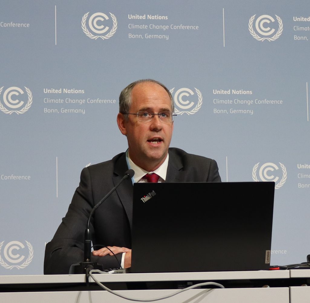
Most recently, Chris’ work has examined the sensitivity of the ice sheets to specific temperature targets, such as those in the Paris Climate Agreement. This has led to opportunities to present his work to policymakers at the Conference of the Parties (COPs) and meetings of the Subsidiary Bodies of the United Nations Framework Convention on Climate Change, as well as extensive media engagement and outreach activities.
Chris’ research has been funded from a range of sources (e.g. NERC, Leverhulme Trust) totalling over £5 million and supported by a large network of international collaborations that has seen him publish on all of the world’s major glaciated regions (and even those on Mars). He has also benefitted from, and been inspired by, supervising/hosting several postdoctoral researchers, over 20 Ph.D. students, and numerous Masters by Research students.
He has published over 150 papers in international peer-reviewed journals, in addition to numerous invited book chapters and Encyclopedia entries. These research contributions have been recognised through a Philip Leverhulme Prize (2009) and the British Society for Geomorphology’s Gordon Warwick Medal (2013). Chris has also won a University award for Excellence in Doctoral Supervision (2016) and a Green Gown Award for innovation in Education (2021).
Major service roles in academia include Vice-President (2013-2015) and President (2015-2017) of the International Glaciological Society’s British Branch and Steering Committee membership of the Palaeo-Arc research network (2019-2025). He has also served on the Editorial Board of the Journal of Maps (2012-2016), Geology (2018-2021) and The Cryosphere (2012-2024), and sits on the Editorial Advisory Board of Earth Surface Processes and Landforms. In addition, Chris has served on a number of funding panels and contributes to institutional research evaluation activities, both in the UK and overseas.
Chris currently teaches modules on climate change, glaciers and glaciation and the Arctic, and particularly enjoys fieldtrips. He also acts as a cryosphere consultant for the Guinness World Records and supports Oldham Athletic football club.
Former PhD Students
- Emma Carr (2025): The response of marine-terminating outlet glaciers in northwestern Greenland to recent climate change
- Oliver Hall (2025): Investigating the seasonal behaviour of tidewater glaciers in southeast Greenland
- Greta Ferloni (2024): Cryomobilities: Vessel mobilities amidst the ice-prone waters of the Bering Strait
- Jennifer Arthur (2022): Satellite remote sensing of supraglacial lakes in East Antarctica
- Laura Seddon (2022): Measurement, knowledge, and representation: a sociological study of Arctic sea-ice science
- Mihaela Newton (2022): The origin of bedrock mega-grooves in glaciated terrain
- Joshua Leigh (2022): Fluctuations of mountain glaciers in northern Norway throughout the Holocene
- Arminel Lovell (2021): Explaining recent heterogeneous glacier change in the Annapurna Conservation Area, central Himalayas
- Emily Hill (2020): The past and future impact of ice tongue loss on outlet glaciers in northern Greenland
- Bertie Miles (2017): The patterns and drivers of recent outlet glacier change in East Antarctica
- Hannah Bickerdike (2017): The glacial geomorphology of the Loch Lomond (Younger Dryas) Stadial in Britain
- Christopher Darvill (2015): The nature and timing of glaciation in southermost South America.
- Rachel Carr (2014): Ice-ocean-atmosphere interactions in the Arctic Seas.
- Robert Storrar (2014): Reconstructing subglacial meltwater dynamics from the spatial and temporal variation in the form and pattern of eskers.
- Andrew Turner (2013): Deglaciation of the Great Glen, Scotland: reconstructed from geophysical surveys and landform mapping.
- Philip Prescott (2013): Quantifying subglacial roughness and its link to glacial geomorphology and ice speed.
- Heather Channon (2012): Multi-scale analysis of the landforms and sediments of palaeo-ice streams.
- Victoria Brown (2012): Ice stream dynamics at the north-western margin of the Laurentide Ice Sheet.
- Katie Grant (2010): Changes in glacier extent since the Little Ice Age and links to 20th/21st Century climatic variability on Novaya Zemlya, Russian Arctic.
Esteem Indicators
- 2021: Green Gown Award (UK & Ireland): “Green Gown Awards provide the sector with inspiration and benchmarks for climate and wider sustainability excellence”. This was awarded for a Virtual Fieldtrip project that won the Enterprise category, which "recognises social, social media and sustainable enterprise as key ingredients of contemporary education to ensure a supply of education leavers who can rise to the 21st Century’s economic, environmental and social challenges”.
- 2016: Durham University ‘Excellence in Doctoral Supervision Award’: “The purpose of these awards is to promote, recognise and reward excellence in doctoral supervision. The award will be made to members of the University's staff who can demonstrate excellence in the supervision of doctoral students, including those studying for the PhD, professional doctorates, and the PhD with integrated studies”
- 2013: British Society for Geomorphology Gordon Warwick Award: “Awarded for excellence in geomorphological research by someone within 15 years of being awarded their doctorate
- 2009: British Society for Geomorphology Wiley Award: Awarded for the best paper published in the international journal 'Earth Surface Processes and Landforms'
- 2009: Philip Leverhulme Prize: Awarded to outstanding scholars or practitioners (normally under the age of 36) who have made a substantial and recognised contribution to their particular field of study, recognised at an international level, and whose future contributions are held to be of correspondingly high promise
Publications
Chapter in book
- DrumlinStokes, C., & Korteniemi, J. (2014). Drumlin. In A. Kereszturi & H. Hargitai (Eds.), The Encylopdeia of Planetary Landforms. Springer Verlag. https://doi.org/10.1007/978-1-4614-9213-9_161-1
- Evidence of Glacier Flow Directions.Stokes, C. (2013). Evidence of Glacier Flow Directions. In S. Elias (Ed.), The Encyclopedia of Quaternary Science. (pp. 895-908). Elsevier.
- Evidence from geophysical surveys for Younger Dryas (jökulhlaup) sedimentation within Loch Ness.Turner, A., Woodward, J., Dunning, S., Shine, A., Stokes, C., & O’Cofaigh, C. (2013). Evidence from geophysical surveys for Younger Dryas (jökulhlaup) sedimentation within Loch Ness. In C. Boston, S. Lukas, & J. Merritt (Eds.), The Quaternary of the Monadhliath Mountains and Great Glen: Field Guide. (pp. 89-92). Quaternary Research Association.
- The deglaciation of the Great Glen based on the results of geophysical surveys within Loch Ness.Turner, A., Woodward, J., Dunning, S., Shine, A., Stokes, C., & O’Cofaigh, C. (2013). The deglaciation of the Great Glen based on the results of geophysical surveys within Loch Ness. In C. Boston, S. Lukas, & J. Merritt (Eds.), The Quaternary of the Monadhliath Mountains and Great Glen: Field Guide. (pp. 83-88). Quaternary Research Association.
- 'Caucasus Mountains' ; 'Novaya Zemlya' ; 'Palaeo-Ice Stream'Stokes, C. (2011). ’Caucasus Mountains’ ; ’Novaya Zemlya’ ; ’Palaeo-Ice Stream’. In V. Singh, P. Singh, & U. Haritshaya (Eds.), Encyclopedia of snow, ice and glaciers. (pp. 803-808,781,127-128). Springer Verlag.
- New insights regarding rapid ice flow from the Thelon Valley, Nunavut Territory.Stokes, C. (2010). New insights regarding rapid ice flow from the Thelon Valley, Nunavut Territory. In L. Chow & K. McKay (Eds.), Hudson Bay Regional Research. (pp. 50-52). Aboriginal Issues Press.
- Climate change, glacier retreat, and water availability in the Caucasus region.Shahgedanova, M., Hagg, W., Hassell, D., Stokes, C., & Popovnin, V. (2009). Climate change, glacier retreat, and water availability in the Caucasus region. In J. Jones, T. Vardanian, & C. Hakopian (Eds.), Threats to Global Water Security; NATO Science for Peace and Security Series C - Environmental Security. (pp. 131-143). Springer Verlag.
- Influence of Ice Streaming on the Ocean-Climate System: Examining the Impact of the M'Clintock Channel Ice Stream, Canadian Arctic Archipelago.Stokes, C., & Clark, C. (2006). Influence of Ice Streaming on the Ocean-Climate System: Examining the Impact of the M’Clintock Channel Ice Stream, Canadian Arctic Archipelago. In P. Knight (Ed.), Glacier Science and Environmental Change. (pp. 135-136). Blackwell.
- What can the 'footprint' of a palaeo-ice stream tell us? Interpreting the bed of the Dubawnt Lake Ice Stream, Northern Keewatin, Canada.Stokes, C., & Clark, C. (2006). What can the ’footprint’ of a palaeo-ice stream tell us? Interpreting the bed of the Dubawnt Lake Ice Stream, Northern Keewatin, Canada. In P. Knight (Ed.), Glacier Science and Environmental Change. (pp. 208-209). Blackwell.
- 'Ice Sheet' and 'Ice Stream'.Stokes, C. (2003). ’Ice Sheet’ and ’Ice Stream’. In A. Goudie (Ed.), Encyclopedia of Geomorphology. Routledge.
- Palaeo-Ice Stream Landsystem.Clark, C., & Stokes, C. (2003). Palaeo-Ice Stream Landsystem. In D. Evans (Ed.), Glacial Landsystems. (pp. 204-227). Arnold.
Journal Article
- Warming of +1.5 °C is too high for polar ice sheetsStokes, C. R., Bamber, J. L., Dutton, A., & DeConto, R. M. (2025). Warming of +1.5 °C is too high for polar ice sheets. Communications Earth & Environment, 6, Article 351. https://doi.org/10.1038/s43247-025-02299-w
- Ice flow dynamics of the northwestern Laurentide Ice Sheet during the last deglaciationStoker, B. J., Dulfer, H. E., Stokes, C. R., Brown, V. H., Clark, C. D., O’Cofaigh, C., Evans, D. J., Froese, D., Norris, S. L., & Margold, M. (2025). Ice flow dynamics of the northwestern Laurentide Ice Sheet during the last deglaciation. The Cryosphere, 19(2), 869–910. https://doi.org/10.5194/tc-19-869-2025
- Distribution and Morphometry of Large Supraglacial Channels on Five Antarctic Ice ShelvesChen, J., Hodge, R. A., Jamieson, S. S., & Stokes, C. R. (2025). Distribution and Morphometry of Large Supraglacial Channels on Five Antarctic Ice Shelves. Journal of Glaciology, 71, Article e18. https://doi.org/10.1017/jog.2024.99
- Ice dynamics and structural evolution of Jutulstraumen, Dronning Maud Land, East Antarctica (1963-2022)Sharma, A., Stokes, C. R., & Jamieson, S. S. (2025). Ice dynamics and structural evolution of Jutulstraumen, Dronning Maud Land, East Antarctica (1963-2022). Journal of Glaciology, 71, Article e65. https://doi.org/10.1017/jog.2025.29
- Reconstructing the Holocene glacial history of northern Troms and western Finnmark, Arctic NorwayLeigh, J. R., Jones, R. S., Stokes, C. R., Evans, D. J. A., Carr, J. R., & Andreassen, L. M. (2024). Reconstructing the Holocene glacial history of northern Troms and western Finnmark, Arctic Norway. Boreas, 53(4, Special issue: Late Middle Pleistocene (MIS 11‐6) in Europe), 619-654. https://doi.org/10.1111/bor.12668
- Remote sensing of glacier change (1965 - 2021) and identification of surge-type glaciers on Severnaya Zemlya, Russian High ArcticWytiahlowsky, H., Stokes, C. R., & Evans, D. J. (2023). Remote sensing of glacier change (1965 - 2021) and identification of surge-type glaciers on Severnaya Zemlya, Russian High Arctic. Journal of Glaciology, 69(278), 1764-1784. https://doi.org/10.1017/jog.2023.60
- Extensive and anomalous grounding line retreat at Vanderford Glacier, Vincennes Bay, Wilkes Land, East AntarcticaPicton, H. J., Stokes, C. R., Jamieson, S. S. R., Floricioiu, D., & Krieger, L. (2023). Extensive and anomalous grounding line retreat at Vanderford Glacier, Vincennes Bay, Wilkes Land, East Antarctica. The Cryosphere, 17(8), 3593–3616. https://doi.org/10.5194/tc-17-3593-2023
- Characteristics and formation of bedrock mega-grooves (BMGs) in glaciated terrain: 1 - morphometric analysesNewton, M., Stokes, C. R., Roberts, D. H., & Evans, D. J. (2023). Characteristics and formation of bedrock mega-grooves (BMGs) in glaciated terrain: 1 - morphometric analyses. Geomorphology, 427. https://doi.org/10.1016/j.geomorph.2023.108619
- Characteristics and formation of bedrock mega-grooves (BMGs) in glaciated terrain: 2 – conceptual models of BMG initiationEvans, D. J., Newton, M., Roberts, D. H., & Stokes, C. R. (2023). Characteristics and formation of bedrock mega-grooves (BMGs) in glaciated terrain: 2 – conceptual models of BMG initiation. Geomorphology, 427. https://doi.org/10.1016/j.geomorph.2023.108620
- Slowdown of Shirase Glacier, East Antarctica, caused by strengthening alongshore windsMiles, B. W., Stokes, C. R., Jenkins, A., Jordan, J. R., Jamieson, S. S., & Gudmundsson, G. H. (2023). Slowdown of Shirase Glacier, East Antarctica, caused by strengthening alongshore winds. The Cryosphere, 17(1), 445-456. https://doi.org/10.5194/tc-17-445-2023
- Glacial geomorphology of the northwest Laurentide Ice Sheet on the northern Interior Plains and western Canadian Shield, CanadaDulfer, H. E., Stoker, B. J., Margold, M., & Stokes, C. R. (2023). Glacial geomorphology of the northwest Laurentide Ice Sheet on the northern Interior Plains and western Canadian Shield, Canada. Journal of Maps, 19(1), Article 2181714. https://doi.org/10.1080/17445647.2023.2181714
- Increased warm water intrusions could cause mass loss in East Antarctica during the next 200 yearsJordan, J. R., Miles, B., Gudmundsson, G., Jamieson, S., Jenkins, A., & Stokes, C. (2023). Increased warm water intrusions could cause mass loss in East Antarctica during the next 200 years. Nature Communications, 14(1), Article 1825. https://doi.org/10.1038/s41467-023-37553-2
- Response of the East Antarctic Sheet to Past and Future Climate ChangeStokes, C. R., Abram, N. J., Bentley, M. J., Edwards, T. L., England, M. H., Foppert, A., Jamieson, S. S., Jones, R. S., King, M. A., Lenaerts, J. T., Medley, B., Miles, B. W., Paxman, G. J., Ritz, C., van de Flierdt, T., & Whitehouse, P. (2022). Response of the East Antarctic Sheet to Past and Future Climate Change. Nature, 608, 275-286. https://doi.org/10.1038/s41586-022-04946-0
- The sensitivity of Cook Glacier, East Antarctica, to changes in ice-shelf extent and grounding-line positionJordan, J., Gudmundsson, G., Jenkins, A., Stokes, C., Miles, B., & Jamieson, S. (2022). The sensitivity of Cook Glacier, East Antarctica, to changes in ice-shelf extent and grounding-line position. Journal of Glaciology, 68(269), 473-485. https://doi.org/10.1017/jog.2021.106
- Large interannual variability in supraglacial lakes around East AntarcticaArthur, J. F., Stokes, C. R., Jamieson, S. S., Rachel Carr, J., Leeson, A. A., & Verjans, V. (2022). Large interannual variability in supraglacial lakes around East Antarctica. Nature Communications, 13(1). https://doi.org/10.1038/s41467-022-29385-3
- Introduction: Processes and Palaeo-Environmental Changes in the Arctic from Past to Present (PalaeoArc) special issueLyså, A., Jennings, A., Morigi, C., Stokes, C. R., & Winsborrow, M. C. (2022). Introduction: Processes and Palaeo-Environmental Changes in the Arctic from Past to Present (PalaeoArc) special issue. Arctic, Antarctic, and Alpine Research, 54(1), 640-647. https://doi.org/10.1080/15230430.2022.2154985
- Evolution of the Laurentide and Innuitian ice sheets prior to the Last Glacial Maximum (115 ka to 25 ka)Dalton, A., Stokes, C., & Batchelor, C. (2022). Evolution of the Laurentide and Innuitian ice sheets prior to the Last Glacial Maximum (115 ka to 25 ka). Earth-Science Reviews, 224, Article 103875. https://doi.org/10.1016/j.earscirev.2021.103875
- High spatial and temporal variability in Antarctic ice discharge linked to ice shelf buttressing and bed geometryMiles, B., Stokes, C., Jamieson, S., Jordan, J., Gudmundsson, G., & Jenkins, A. (2022). High spatial and temporal variability in Antarctic ice discharge linked to ice shelf buttressing and bed geometry. Scientific Reports, 12, Article 10968. https://doi.org/10.1038/s41598-022-13517-2
- The triggers of the disaggregation of Voyeykov Ice Shelf (2007), Wilkes Land, East Antarctica, and its subsequent evolutionArthur, J. F., Stokes, C. R., Jamieson, S. S., Miles, B. W., Carr, J. R., & Leeson, A. A. (2021). The triggers of the disaggregation of Voyeykov Ice Shelf (2007), Wilkes Land, East Antarctica, and its subsequent evolution. Journal of Glaciology, 67(265), 933-951. https://doi.org/10.1017/jog.2021.45
- Recent progress on combining geomorphological and geochronological data with ice 1 sheet modelling, demonstrated using the last British-Irish Ice SheetEly, J., Clark, C., Hindmarsh, R., Hughes, A., Greenwood, S., Bradley, S., Gasson, E., Gregoire, L., Gandy, N., Stokes, C., & Small, D. (2021). Recent progress on combining geomorphological and geochronological data with ice 1 sheet modelling, demonstrated using the last British-Irish Ice Sheet. Journal of Quaternary Science, 36(5), 946-960. https://doi.org/10.1002/jqs.3098
- 21st century response of Petermann Glacier, northwest Greenland to ice shelf lossHill, E., Gudmundsson, G., Carr, J., Stokes, C., & King, H. (2021). 21st century response of Petermann Glacier, northwest Greenland to ice shelf loss. Journal of Glaciology, 67(261), 147-157. https://doi.org/10.1017/jog.2020.97
- Image classification of marine-terminating outlet glaciers in Greenland using deep learning methodsMarochov, M., Stokes, C., & Carbonneau, P. (2021). Image classification of marine-terminating outlet glaciers in Greenland using deep learning methods. The Cryosphere, 15, 5041-5059. https://doi.org/10.5194/tc-15-5041-2021
- Recent acceleration of Denman Glacier (1972-2017), East Antarctica, driven by grounding line retreat and changes in ice tongue configurationMiles, B., Jordan, J., Stokes, C., Jamieson, S., Hilmar Gudmundsson, G., & Jenkins, A. (2021). Recent acceleration of Denman Glacier (1972-2017), East Antarctica, driven by grounding line retreat and changes in ice tongue configuration. Cryosphere, 15, 663-676. https://doi.org/10.5194/tc-2020-162
- Glacial and periglacial geomorphological map of central Troms and Finnmark county, Arctic NorwayLeigh, J., Evans, D., Stokes, C., Andreassen, L., & Carr, R. (2021). Glacial and periglacial geomorphological map of central Troms and Finnmark county, Arctic Norway. Journal of Maps, 17(2), 348-366. https://doi.org/10.1080/17445647.2021.1950580
- Recent understanding of Antarctic supraglacial lakes using satellite remote sensingArthur, J., Stokes, C., Jamieson, S., Carr, J., & Leeson, A. (2020). Recent understanding of Antarctic supraglacial lakes using satellite remote sensing. Progress in Physical Geography, 44(6), 837-869. https://doi.org/10.1177/0309133320916114
- Intermittent structural weakening and acceleration of the Thwaites Glacier Tongue between 2000 and 2018Miles, B., Stokes, C., Jenkins, A., Jordan, J., Jamieson, S., & Gudmundsson, G. (2020). Intermittent structural weakening and acceleration of the Thwaites Glacier Tongue between 2000 and 2018. Journal of Glaciology, 66(257), 485-495. https://doi.org/10.1017/jog.2020.20
- The deglaciation of the Americas during the Last Glacial TerminationPalacios, D., Stokes, C. R., Phillips, F. M., Clague, J. J., Alcalá-Reygosa, J., Andres, N., Angel, I., Blard, P., Briner, J. P., Hall, B. L., Dahms, D., Hein, A. S., Jomelli, V., Mark, B. G., Martini, M. A., Moreno, P., Riedel, J., Sagredo, E., Stansell, N. D., … Ward, D. J. (2020). The deglaciation of the Americas during the Last Glacial Termination. Earth-Science Reviews, 203, Article 103113. https://doi.org/10.1016/j.earscirev.2020.103113
- An updated radiocarbon-based ice margin chronology for the last deglaciation of the North American Ice Sheet ComplexDalton, A., Margold, M., Stokes, C., Tarasov, L., Dyke, A., Adams, R., Allard, S., Arends, H., Atkinson, N., Attig, J., Barnett, P., Barnett, R., Batterson, M., Bernatchez, P., Borns Jr, H., Breckenridge, A., Briner, J., Brouard, E., Campbell, J., … Wright Jr, H. (2020). An updated radiocarbon-based ice margin chronology for the last deglaciation of the North American Ice Sheet Complex. Quaternary Science Reviews, 234, Article 106223. https://doi.org/10.1016/j.quascirev.2020.106223
- Distribution and seasonal evolution of supraglacial lakes on Shackleton Ice Shelf, East AntarcticaArthur, J., Stokes, C., Jamieson, S., Carr, J., & Leeson, A. (2020). Distribution and seasonal evolution of supraglacial lakes on Shackleton Ice Shelf, East Antarctica. Cryosphere, 14(11), 4103-4120. https://doi.org/10.5194/tc-14-4103-2020
- Timing of Little Ice Age maxima and subsequent glacier retreat in northern Troms and western Finnmark, northern NorwayLeigh, J., Stokes, C., Evans, D., Carr, R., & Andreassen, L. (2020). Timing of Little Ice Age maxima and subsequent glacier retreat in northern Troms and western Finnmark, northern Norway. Arctic, Antarctic, and Alpine Research, 52(1), 281-311. https://doi.org/10.1080/15230430.2020.1765520
- Controls on the formation of turbidity current channels associated with marine-terminating glaciers and ice sheetsPope, E. L., Normandeau, A., Ó Cofaigh, C., Stokes, C. R., & Talling, P. J. (2019). Controls on the formation of turbidity current channels associated with marine-terminating glaciers and ice sheets. Marine Geology, 415, Article 105951. https://doi.org/10.1016/j.margeo.2019.05.010
- Widespread distribution of supraglacial lakes around the margin of the East Antarctic Ice SheetStokes, C., Sanderson, J., Miles, B., Jamieson, S., & Leeson, A. (2019). Widespread distribution of supraglacial lakes around the margin of the East Antarctic Ice Sheet. Scientific Reports, 9, Article 13823. https://doi.org/10.1038/s41598-019-50343-5
- Spatially Variable Glacier Changes in the Annapurna Conservation Area, Nepal, 2000 to 2016Lovell, A. M., Carr, J. R., & Stokes, C. R. (2019). Spatially Variable Glacier Changes in the Annapurna Conservation Area, Nepal, 2000 to 2016. Remote Sensing, 11(12), Article 1452. https://doi.org/10.3390/rs11121452
- Atmospheric forcing of rapid marine-terminating glacier retreat in the Canadian Arctic ArchipelagoCook, A., Copland, L., Noel, B., Stokes, C., Bentley, M., Sharp, M., Bingham, R., & van den Broeke, M. (2019). Atmospheric forcing of rapid marine-terminating glacier retreat in the Canadian Arctic Archipelago. Science Advances, 5(3), Article eaau8507. https://doi.org/10.1126/sciadv.aau8507
- Identifying and mapping very small (<0.5 km2) mountain glaciers on coarse to high-resolution imageryLeigh, J., Stokes, C., Carr, J., Evans, I., Andreassen, L., & Evans, D. (2019). Identifying and mapping very small (<0.5 km2) mountain glaciers on coarse to high-resolution imagery. Journal of Glaciology, 65, 878-888. https://doi.org/10.1017/jog.2019.50
- The configuration of Northern Hemisphere ice sheets through the QuaternaryBatchelor, C., Margold, M., Krapp, M., Murton, D., Dalton, A., Gibbard, P., Stokes, C., Murton, J., & Manica, A. (2019). The configuration of Northern Hemisphere ice sheets through the Quaternary. Nature Communications, 10, Article 3713. https://doi.org/10.1038/s41467-019-11601-2
- Velocity response of Petermann Glacier, northwest Greenland, to past and future calving eventsHill, E., Hilmar Gudmundsson, G., Carr, R., & Stokes, C. (2018). Velocity response of Petermann Glacier, northwest Greenland, to past and future calving events. Cryosphere, 12(12), 3907-3921. https://doi.org/10.5194/tc-12-3907-2018
- Dynamic changes in outlet glaciers in northern Greenland from 1948 to 2015Hill, E., Carr, J., Stokes, C., & Gudmundsson, G. (2018). Dynamic changes in outlet glaciers in northern Greenland from 1948 to 2015. Cryosphere, 12(10), 3243-3263. https://doi.org/10.5194/tc-12-3243-2018
- Velocity increases at Cook Glacier, East Antarctica linked to ice shelf loss and a subglacial flood eventMiles, B., Stokes, C., & Jamieson, S. (2018). Velocity increases at Cook Glacier, East Antarctica linked to ice shelf loss and a subglacial flood event. Cryosphere, 12(10), 3123-3136. https://doi.org/10.5194/tc-12-3123-2018
- Bedrock mega-grooves in glaciated terrain: a reviewNewton, M., Evans, D., Roberts, D., & Stokes, C. (2018). Bedrock mega-grooves in glaciated terrain: a review. Earth-Science Reviews, 185, 57-79. https://doi.org/10.1016/j.earscirev.2018.03.007
- Lack of evidence for a substantial sea-level fluctuation within the Last InterglacialBarlow, N., McClymont, E., Whitehouse, P., Stokes, C., Jamieson, S., Woodroffe, S., Bentley, M., Callard, S., Ó Cofaigh, C., Evans, D., Horrocks, J., Lloyd, J., Long, A., Margold, M., Roberts, D., & Sanchez-Montes, M. (2018). Lack of evidence for a substantial sea-level fluctuation within the Last Interglacial. Nature Geoscience, 11, 627-634. https://doi.org/10.1038/s41561-018-0195-4
- Relationship between mega-scale glacial lineations and iceberg ploughmarks on the Bjørnøyrenna Palaeo-Ice Stream bed, Barents SeaPiasecka, E. D., Stokes, C. R., Winsborrow, M. C., & Andreassen, K. (2018). Relationship between mega-scale glacial lineations and iceberg ploughmarks on the Bjørnøyrenna Palaeo-Ice Stream bed, Barents Sea. Marine Geology, 402, 153-164. https://doi.org/10.1016/j.margeo.2018.02.008
- Topographic controls on the surging behaviour of Sabche Glacier, Nepal (1967 to 2017)Lovell, A., Carr, J., & Stokes, C. (2018). Topographic controls on the surging behaviour of Sabche Glacier, Nepal (1967 to 2017). Remote Sensing of Environment, 210, 434-443. https://doi.org/10.1016/j.rse.2018.03.036
- Reconciling records of ice streaming and ice margin retreat to produce a palaeogeographic reconstruction of the deglaciation of the Laurentide Ice SheetMargold, M., Stokes, C., & Clark, C. (2018). Reconciling records of ice streaming and ice margin retreat to produce a palaeogeographic reconstruction of the deglaciation of the Laurentide Ice Sheet. Quaternary Science Reviews, 189, 1-30. https://doi.org/10.1016/j.quascirev.2018.03.013
- Using the size and position of drumlins to understand how they grow, interact and evolveEly, J., Clark, C., Spagnolo, M., Hughes, A., & Stokes, C. (2018). Using the size and position of drumlins to understand how they grow, interact and evolve. Earth Surface Processes and Landforms, 43(5), 1073-1087. https://doi.org/10.1002/esp.4241
- Widespread and accelerating glacier retreat on the Lyngen Peninsula, northern Norway, since their ‘Little Ice Age’ maximumStokes, C., Andreassen, L., Champion, M., & Corner, G. (2018). Widespread and accelerating glacier retreat on the Lyngen Peninsula, northern Norway, since their ‘Little Ice Age’ maximum. Journal of Glaciology, 64(243), 100-118. https://doi.org/10.1017/jog.2018.3
- Spatial organization of drumlinsClark, C. D., Ely, J. C., Spagnolo, M., Hahn, U., Hughes, A. L., & Stokes, C. R. (2018). Spatial organization of drumlins. Earth Surface Processes and Landforms, 43(2), 499-513. https://doi.org/10.1002/esp.4192
- The Glacial Geomorphology of the Loch Lomond (Younger Dryas) Stadial in Britain: a reviewBickerdike, H., Evans, D., Stokes, C., & Ó Cofaigh, C. (2018). The Glacial Geomorphology of the Loch Lomond (Younger Dryas) Stadial in Britain: a review. Journal of Quaternary Science, 33(1), 1-54. https://doi.org/10.1002/jqs.3010
- Glacial landsystems, retreat dynamics and controls on Loch Lomond Stadial (Younger Dryas) glaciation in BritainBickerdike, H., Ó Cofaigh, C., Evans, D., & Stokes, C. (2018). Glacial landsystems, retreat dynamics and controls on Loch Lomond Stadial (Younger Dryas) glaciation in Britain. Boreas, 47(1), 202-224. https://doi.org/10.1111/bor.12259
- Geomorphology under ice streams: moving from form to processStokes, C. (2018). Geomorphology under ice streams: moving from form to process. Earth Surface Processes and Landforms, 43(1), 85-123. https://doi.org/10.1002/esp.4259
- Sub-decadal variations in outlet glacier terminus positions in Victoria Land, Oates Land and George V Land, East Antarctica (1972-2013)Lovell, A., Stokes, C., & Jamieson, S. (2017). Sub-decadal variations in outlet glacier terminus positions in Victoria Land, Oates Land and George V Land, East Antarctica (1972-2013). Antarctic Science, 29(5), 468-483. https://doi.org/10.1017/s0954102017000074
- The periodic topography of ice stream beds: Insights from the Fourier spectra of mega-scale glacial lineationsSpagnolo, M., Bartholomaus, T. C., Clark, C. D., Stokes, C. R., Atkinson, N., Dowdeswell, J. A., Ely, J. C., Graham, A. G., Hogan, K. A., King, E. C., Larter, R. D., Livingstone, S. J., & Pritchard, H. D. (2017). The periodic topography of ice stream beds: Insights from the Fourier spectra of mega-scale glacial lineations. Journal of Geophysical Research. Earth Surface., 122(7), 1355-1373. https://doi.org/10.1002/2016jf004154
- Deglaciation of the Laurentide Ice Sheet from the Last Glacial MaximumStokes, C. (2017). Deglaciation of the Laurentide Ice Sheet from the Last Glacial Maximum. Cuadernos de Investigación Geográfica, 43(2), 377-428. https://doi.org/10.18172/cig.3237
- Threefold increase in marine-terminating outlet glacier retreat rates across the Atlantic Arctic: 1992-2010Carr, R., Stokes, C., & Vieli, A. (2017). Threefold increase in marine-terminating outlet glacier retreat rates across the Atlantic Arctic: 1992-2010. Journal of Glaciology, 58(4), 72-91. https://doi.org/10.1017/aog.2017.3
- Simultaneous disintegration of outlet glaciers in Porpoise Bay (Wilkes Land), East Antarctica, driven by sea ice break-upMiles, B., Stokes, C., & Jamieson, S. (2017). Simultaneous disintegration of outlet glaciers in Porpoise Bay (Wilkes Land), East Antarctica, driven by sea ice break-up. Cryosphere, 11, 427-442. https://doi.org/10.5194/tc-11-427-2017
- A review of recent changes in major marine-terminating outlet glaciers in northern GreenlandHill, E., Carr, R., & Stokes, C. (2017). A review of recent changes in major marine-terminating outlet glaciers in northern Greenland. Frontiers in Earth Science, 4, Article 11. https://doi.org/10.3389/feart.2016.00111
- Reconstructing the retreat dynamics of the Bjørnøyrenna Ice Stream based on new 3D seismic geomorphology from the central Barents SeaPiasecka, E., Winsborrow, M., Andreassen, K., & Stokes, C. (2016). Reconstructing the retreat dynamics of the Bjørnøyrenna Ice Stream based on new 3D seismic geomorphology from the central Barents Sea. Quaternary Science Reviews, 151, 212-227. https://doi.org/10.1016/j.quascirev.2016.09.003
- The glacial geomorphology of the Loch Lomond Stadial in Britain: a map and geographic information system resource of published evidenceBickerdike, H., Evans, D., Ó Cofaigh, C., & Stokes, C. (2016). The glacial geomorphology of the Loch Lomond Stadial in Britain: a map and geographic information system resource of published evidence. Journal of Maps, 12(5), 1178-1186. https://doi.org/10.1080/17445647.2016.1145149
- The surficial and subglacial geomorphology of western Dronning Maud Land, AntarcticaChang, M., Jamieson, S., Bentley, M., & Stokes, C. (2016). The surficial and subglacial geomorphology of western Dronning Maud Land, Antarctica. Journal of Maps, 12(5), 892-903. https://doi.org/10.1080/17445647.2015.1097289
- The timing and cause of glacial advances in the southern mid-latitudes during the last glacial cycle based on a synthesis of exposure ages from Patagonia and New ZealandDarvill, C., Bentley, M., Stokes, C., & Shulmeister, J. (2016). The timing and cause of glacial advances in the southern mid-latitudes during the last glacial cycle based on a synthesis of exposure ages from Patagonia and New Zealand. Quaternary Science Reviews, 149, 200-214. https://doi.org/10.1016/j.quascirev.2016.07.024
- Dynamics of former ice lobes of the southernmost Patagonian Ice Sheet based on a glacial landsystems approachDarvill, C., Stokes, C., Bentley, M., Evans, D., & Lovell, H. (2016). Dynamics of former ice lobes of the southernmost Patagonian Ice Sheet based on a glacial landsystems approach. Journal of Quaternary Science, 32(6), 857-876. https://doi.org/10.1002/jqs.2890
- Seasonal evolution of supraglacial lakes on an East Antarctic outlet glacierLangley, E., Leeson, A., Stokes, C., & Jamieson, S. (2016). Seasonal evolution of supraglacial lakes on an East Antarctic outlet glacier. Geophysical Research Letters, 43(16), 8563-8571. https://doi.org/10.1002/2016gl069511
- Ribbed bedforms on palaeo-ice stream beds resemble regular patterns of basal shear stress (‘traction ribs’) inferred from modern ice streamsStokes, C., Margold, M., & Creyts, T. (2016). Ribbed bedforms on palaeo-ice stream beds resemble regular patterns of basal shear stress (‘traction ribs’) inferred from modern ice streams. Journal of Glaciology, 62(234), 696-713. https://doi.org/10.1017/jog.2016.63
- Subglacial bedform morphology controlled by ice speed and sediment thicknessBarchyn, T., Dowling, T., Stokes, C., & Hugenholtz, C. (2016). Subglacial bedform morphology controlled by ice speed and sediment thickness. Geophysical Research Letters, 43(14), 7572-7580. https://doi.org/10.1002/2016gl069558
- Exploring Explanations of Subglacial Bedform Sizes Using Statistical ModelsHillier, J., Kougioumtzoglou, I., Stokes, C., Smith, M., Clark, C., & Spagnolo, M. (2016). Exploring Explanations of Subglacial Bedform Sizes Using Statistical Models. PLoS ONE, 11(7), Article e0159489. https://doi.org/10.1371/journal.pone.0159489
- Landform assemblages and sedimentary processes along the Norwegian Channel Ice StreamOtteson, D., Stokes, C., Bøe, R., Rise, L., Longva, O., Thorsnes, T., Olesen, O., Bugge, T., Lepland, A., & Hestvik, O. (2016). Landform assemblages and sedimentary processes along the Norwegian Channel Ice Stream. Sedimentary Geology, 338, 115-137. https://doi.org/10.1016/j.sedgeo.2016.01.024
- Pan–ice-sheet glacier terminus change in East Antarctica reveals sensitivity of Wilkes Land to sea-ice changesMiles, B., Stokes, C., & Jamieson, S. (2016). Pan–ice-sheet glacier terminus change in East Antarctica reveals sensitivity of Wilkes Land to sea-ice changes. Science Advances, 2(5), Article e1501350. https://doi.org/10.1126/sciadv.1501350
- Subglacial processes on an Antarctic ice stream bed. 2: Can modelled ice dynamics explain the morphology of mega-scale glacial lineations?Jamieson, S., Stokes, C., Livingstone, S., Vieli, A., Ò Cofaigh, C., Hillenbrand, C., & Spagnolo, M. (2016). Subglacial processes on an Antarctic ice stream bed. 2: Can modelled ice dynamics explain the morphology of mega-scale glacial lineations? Journal of Glaciology, 62(232), 285-298. https://doi.org/10.1017/jog.2016.19
- Subglacial processes on an Antarctic ice stream bed. 1: Sediment transport and bedform genesis inferred from marine geophysical dataLivingstone, S., Stokes, C., O Cofaigh, C., Hillenbrand, C., Vieli, A., Jamieson, S., Spagnolo, M., & Dowdeswell, J. (2016). Subglacial processes on an Antarctic ice stream bed. 1: Sediment transport and bedform genesis inferred from marine geophysical data. Journal of Glaciology, 62(232), 270-284. https://doi.org/10.1017/jog.2016.18
- Do subglacial bedforms comprise a size and shape continuum?Ely, J., Clark, C., Spagnolo, M., Stokes, C., Greenwood, S., Hughese, A., Dunlopf, P., & Hessg, D. (2016). Do subglacial bedforms comprise a size and shape continuum? Geomorphology, 257, 108-119. https://doi.org/10.1016/j.geomorph.2016.01.001
- Ice stream motion facilitated by a shallow-deforming and accreting bedSpagnolo, M., Phillips, E., Piotrowski, J., Rea, B., Clark, C., Stokes, C., Carr, S., Ely, J., Ribolini, A., Wysota, W., & Szuman, I. (2016). Ice stream motion facilitated by a shallow-deforming and accreting bed. Nature Communications, 7, Article 10723. https://doi.org/10.1038/ncomms10723
- Ice stream activity scaled to ice sheet volume during Laurentide Ice Sheet deglaciationStokes, C., Margold, M., Clark, C., & Tarasov, L. (2016). Ice stream activity scaled to ice sheet volume during Laurentide Ice Sheet deglaciation. Nature, 530(7590), 322-326. https://doi.org/10.1038/nature16947
- Extensive MIS 3 glaciation in southernmost Patagonia revealed by cosmogenic nuclide dating of outwash sedimentsDarvill, C., Bentley, M., Stokes, C., Hein, A., & Rodés, A. (2015). Extensive MIS 3 glaciation in southernmost Patagonia revealed by cosmogenic nuclide dating of outwash sediments. Earth and Planetary Science Letters, 429, 157-169. https://doi.org/10.1016/j.epsl.2015.07.030
- An ice-sheet scale comparison of eskers with modelled subglacial drainage routesLivingstone, S., Storrar, R., Hillier, J., Stokes, C., Clark, C., & Tarasov, L. (2015). An ice-sheet scale comparison of eskers with modelled subglacial drainage routes. Geomorphology, 246, 104-112. https://doi.org/10.1016/j.geomorph.2015.06.016
- On the Reconstruction of Palaeo-Ice Sheets: Recent Advances and Future ChallengesStokes, C., Tarasov, L., Blomdin, R., Cronin, T., Fisher, T., Gyllencreutz, R., Hättestrand, C., Heyman, J., Hindmarsh, R., Hughes, A., Jakobsson, M., Kirchner, N., Livingstone, S., Margold, M., Murton, J., Noormets, R., Peltier, W., Peteet, D., Piper, D., … Teller, J. (2015). On the Reconstruction of Palaeo-Ice Sheets: Recent Advances and Future Challenges. Quaternary Science Reviews, 125, 15-49. https://doi.org/10.1016/j.quascirev.2015.07.016
- Controls on the location, morphology and evolution of complex esker systems at decadal timescales, Breiðamerkurjökull, southeast IcelandStorrar, R., Evans, D., Stokes, C., & Ewertowski, M. (2015). Controls on the location, morphology and evolution of complex esker systems at decadal timescales, Breiðamerkurjökull, southeast Iceland. Earth Surface Processes and Landforms, 40(11), 1421-1438. https://doi.org/10.1002/esp.3725
- Ice streams in the Laurentide Ice Sheet: a new mapping inventoryMargold, M., Stokes, C., Clark, C., & Kleman, J. (2015). Ice streams in the Laurentide Ice Sheet: a new mapping inventory. Journal of Maps, 11(3), 380-395. https://doi.org/10.1080/17445647.2014.912036
- Ice streams in the Laurentide Ice Sheet: identification, characteristics and comparison to modern ice sheetsMargold, M., Stokes, C., & Clark, C. (2015). Ice streams in the Laurentide Ice Sheet: identification, characteristics and comparison to modern ice sheets. Earth-Science Reviews, 143, 117-146. https://doi.org/10.1016/j.earscirev.2015.01.011
- Basal topographic controls on rapid retreat of Humboldt Glacier, northern GreenlandCarr, J., Vieli, A., Stokes, C., Jamieson, S., Palmer, S., Christoffersen, P., Dowdeswell, J., Nick, F., Blankenship, D., & Young, D. (2015). Basal topographic controls on rapid retreat of Humboldt Glacier, northern Greenland. Journal of Glaciology, 61(225), 137-150. https://doi.org/10.3189/2015jog14j128
- Geomorphology and weathering characteristics of erratic boulder trains on Tierra del Fuego, southernmost South America: implications for dating of glacial depositsDarvill, C. M., Bentley, M. J., & Stokes, C. R. (2015). Geomorphology and weathering characteristics of erratic boulder trains on Tierra del Fuego, southernmost South America: implications for dating of glacial deposits. Geomorphology, 228, 382-397. https://doi.org/10.1016/j.geomorph.2014.09.017
- Morphometry and pattern of a large sample (>20,000) of Canadian eskers and implications for subglacial drainage beneath ice sheetsStorrar, R., Stokes, C., & Evans, D. (2014). Morphometry and pattern of a large sample (>20,000) of Canadian eskers and implications for subglacial drainage beneath ice sheets. Quaternary Science Reviews, 105(1), 1-25. https://doi.org/10.1016/j.quascirev.2014.09.013
- The Glacial Geomorphology of the Antarctic Ice Sheet BedJamieson, S., Stokes, C., Ross, N., Rippin, D., Bingham, R., Wilson, D., Margold, M., & Bentley, M. (2014). The Glacial Geomorphology of the Antarctic Ice Sheet Bed. Antarctic Science, 26(6), 724-741. https://doi.org/10.1017/s0954102014000212
- Size, shape and spatial arrangement of mega-scale glacial lineations from a large and diverse datasetSpagnolo, M., Clark, C., Ely, J., Stokes, C., Anderson, J., Andreassen, K., Graham, A., & King, E. (2014). Size, shape and spatial arrangement of mega-scale glacial lineations from a large and diverse dataset. Earth Surface Processes and Landforms, 39(11), 1432-1448. https://doi.org/10.1002/esp.3532
- Manual mapping of drumlins in synthetic landscapes to assess operator effectivenessHillier, J., Smith, M., Armugam, R., Barr, I., Boston, C., Clark, C., Ely, J., Fankl, J., Greenwood, S., Gosselin, L., Hattestrand, C., Hogan, K., Hughes, A., Livingstone, S., Lovell, H., McHenry, M., Monoz, Y., Pellicer, X., Pellitero, R., … Wooldridge, K. (2014). Manual mapping of drumlins in synthetic landscapes to assess operator effectiveness. Journal of Maps, 11(5), 719-729. https://doi.org/10.1080/17445647.2014.957251
- The Randolph Glacier Inventory: a globally complete inventory of glaciersPfeffer, W. T., Arendt, A. A., Bliss, A., Bolch, T., Cogley, J. G., Gardner, A. S., Hagen, J., Hock, R., Kaser, G., Kienholz, C., Miles, E. S., Moholdt, G., Mölg, N., Paul, F., Radić, V., Rastner, P., Raup, B. H., Rich, J., Sharp, M. J., … Wyatt, F. (2014). The Randolph Glacier Inventory: a globally complete inventory of glaciers. Journal of Glaciology, 60(221), 537-552. https://doi.org/10.3189/2014jog13j176
- Asynchronous response of marine-terminating outlet glaciers during deglaciation of the Fennoscandian Ice SheetStokes, C., Corner, G., Winsborrow, M., Husum, K., & Andreassen, K. (2014). Asynchronous response of marine-terminating outlet glaciers during deglaciation of the Fennoscandian Ice Sheet. Geology, 42(5), 455-458. https://doi.org/10.1130/g35299.1
- A cold hydrological system in Gale Crater, MarsFairen, A., Stokes, C., Davies, N., Schulze-Makuch, D., Rodriguez, J., Davila, A., Uceda, E., Dohm, J., Baker, V., Clifford, S., McKay, C., & Squyres, S. (2014). A cold hydrological system in Gale Crater, Mars. Planetary and Space Science, 93-94, 101-118. https://doi.org/10.1016/j.pss.2014.03.002
- A glacial geomorphological map of the southernmost ice lobes of Patagonia: the Bahía Inútil - San Sebastián, Magellan, Otway, Skyring and Bella Vista lobesDarvill, C., Stokes, C., Bentley, M., & Lovell, H. (2014). A glacial geomorphological map of the southernmost ice lobes of Patagonia: the Bahía Inútil - San Sebastián, Magellan, Otway, Skyring and Bella Vista lobes. Journal of Maps, 10(3), 500-520. https://doi.org/10.1080/17445647.2014.890134
- Understanding controls on rapid ice-stream retreat during the last deglaciation of Marguerite Bay, Antarctica, using a numerical modelJamieson, S., Vieli, A., Ó Cofaigh, C., Stokes, C., Livingstone, S., & Hillenbrand, C. (2014). Understanding controls on rapid ice-stream retreat during the last deglaciation of Marguerite Bay, Antarctica, using a numerical model. Journal of Geophysical Research: Earth Surface, 119(2), 247-263. https://doi.org/10.1002/2013jf002934
- Recent retreat of major outlet glaciers on Novaya Zemlya, Russian Arctic, influenced by fjord geometry and sea-ice conditionsCarr, J., Stokes, C., & Vieli, A. (2014). Recent retreat of major outlet glaciers on Novaya Zemlya, Russian Arctic, influenced by fjord geometry and sea-ice conditions. Journal of Glaciology, 60(219), 155-170. https://doi.org/10.3189/2014jog13j122
- Increased channelization of subglacial drainage during deglaciation of the Laurentide Ice SheetStorrar, R., Stokes, C., & Evans, D. (2014). Increased channelization of subglacial drainage during deglaciation of the Laurentide Ice Sheet. Geology, 42(3), 239-242. https://doi.org/10.1130/g35092.1
- Glacial geomorphology of the Great Glen Region of ScotlandTurner, A., Woodward, J., Stokes, C., O’Cofaigh, C., & Dunning, S. (2014). Glacial geomorphology of the Great Glen Region of Scotland. Journal of Maps, 10(1), 159-178. https://doi.org/10.1080/17445647.2013.866369
- On the size and shape of drumlinsFowler, A., Spagnolo, M., Clark, C., Stokes, C., Hughes, A., & Dunlop, P. (2013). On the size and shape of drumlins. GEM - International Journal on Geomathematics, 4(2), 155-165. https://doi.org/10.1007/s13137-013-0050-0
- Formation of mega-scale glacial lineations on the Dubawnt Lake Ice Stream bed: 2. Sedimentology and stratigraphyO’Cofaigh, C., Stokes, C., Lian, O., Clark, C., & Tulaczyk, S. (2013). Formation of mega-scale glacial lineations on the Dubawnt Lake Ice Stream bed: 2. Sedimentology and stratigraphy. Quaternary Science Reviews, 77, 210-227. https://doi.org/10.1016/j.quascirev.2013.06.028
- Formation of mega-scale glacial lineations on the Dubawnt Lake Ice Stream bed: 1. Size, Shape and Spacing from a large remote sensing datasetStokes, C., Spagnolo, M., Clark, C., O’Cofaigh, C., Lian, O., & Dunstone, R. (2013). Formation of mega-scale glacial lineations on the Dubawnt Lake Ice Stream bed: 1. Size, Shape and Spacing from a large remote sensing dataset. Quaternary Science Reviews, 77, 190-209. https://doi.org/10.1016/j.quascirev.2013.06.003
- Influence of sea ice decline, atmospheric warming, and glacier width on marine-terminating outlet glacier behavior in northwest Greenland at seasonal to interannual timescalesCarr, J., Vieli, A., & Stokes, C. (2013). Influence of sea ice decline, atmospheric warming, and glacier width on marine-terminating outlet glacier behavior in northwest Greenland at seasonal to interannual timescales. Journal of Geophysical Research: Earth Surface, 118(3), 1210-1226. https://doi.org/10.1002/jgrf.20088
- Rapid, climate-driven changes in outlet glaciers on the Pacific coast of East AntarcticaMiles, B., Stokes, C., Vieli, A., & Cox, N. (2013). Rapid, climate-driven changes in outlet glaciers on the Pacific coast of East Antarctica. Nature, 500(7464), 563-566. https://doi.org/10.1038/nature12382
- A map of large Canadian eskers from Landsat satellite imageryStorrar, R., Stokes, C., & Evans, D. (2013). A map of large Canadian eskers from Landsat satellite imagery. Journal of Maps, 9(3), 456-473. https://doi.org/10.1080/17445647.2013.815591
- Evidence for Hesperian glaciation along the Martian dichotomy boundaryDavila, A., Fairen, A., Stokes, C., Platz, T., Rodriguez, A., Lacelle, D., Dohm, J., & Pollard, W. (2013). Evidence for Hesperian glaciation along the Martian dichotomy boundary. Geology, 41(7), 755-758. https://doi.org/10.1130/g34201.1
- Subglacial bedforms reveal an exponential size-frequency distributionHillier, J., Smith, M., Clark, C., Stokes, C., & Spagnolo, M. (2013). Subglacial bedforms reveal an exponential size-frequency distribution. Geomorphology, 190, 82-91. https://doi.org/10.1016/j.geomorph.2013.02.017
- The instability theory of drumlin formation and its explanation of their varied composition and internal structureStokes, C., Fowler, A., Clark, C., Hindmarsh, R., & Spagnolo, M. (2013). The instability theory of drumlin formation and its explanation of their varied composition and internal structure. Quaternary Science Reviews, 62, 77-96. https://doi.org/10.1016/j.quascirev.2012.11.011
- Accelerated loss of alpine glaciers in the Kodar Mountains, south-eastern SiberiaStokes, C., Shahgedanova, M., Evans, I., & Popovnin, V. (2013). Accelerated loss of alpine glaciers in the Kodar Mountains, south-eastern Siberia. Global and Planetary Change, 101, 82-96. https://doi.org/10.1016/j.gloplacha.2012.12.010
- Glacial geomorphology of Marguerite Bay Palaeo-Ice stream, western Antarctic PeninsulaLivingstone, S., O’Cofaigh, C., Stokes, C., Hillenbrand, C., Vieli, A., & Jamieson, S. (2013). Glacial geomorphology of Marguerite Bay Palaeo-Ice stream, western Antarctic Peninsula. Journal of Maps, 9(4), 558-572. https://doi.org/10.1080/17445647.2013.829411
- Recent progress in understanding marine-terminating Arctic outlet glacier response to climatic and oceanic forcing: twenty years of rapid changeCarr, J., Stokes, C., & Vieli, A. (2013). Recent progress in understanding marine-terminating Arctic outlet glacier response to climatic and oceanic forcing: twenty years of rapid change. Progress in Physical Geography, 37(4), 435-466. https://doi.org/10.1177/0309133313483163
- Ice-stream stability on a reverse bed slopeJamieson, S., Vieli, A., Livingstone, S., Ó Cofaigh, C., Stokes, C., Hillenbrand, C., & Dowdeswell, J. (2012). Ice-stream stability on a reverse bed slope. Nature Geoscience, 5(11), 799-802. https://doi.org/10.1038/ngeo1600
- Dynamics of the North American Ice Sheet complex during its inception and build-up to the Last Glacial MaximumStokes, C., Tarasov, L., & Dyke, A. (2012). Dynamics of the North American Ice Sheet complex during its inception and build-up to the Last Glacial Maximum. Quaternary Science Reviews, 50, 86-104. https://doi.org/10.1016/j.quascirev.2012.07.009
- Evidence for rapid ice flow and proglacial lake evolution around the central Strait of Magellan region, southernmost PatagoniaLovell, H., Stokes, C., Bentley, M., & Benn, D. (2012). Evidence for rapid ice flow and proglacial lake evolution around the central Strait of Magellan region, southernmost Patagonia. Journal of Quaternary Science, 27(6), 625-638. https://doi.org/10.1002/jqs.2555
- Ice-stream flow switching during deglaciation of the southwestern Barents SeaWinsborrow, M., Stokes, C., & Andreassen, K. (2012). Ice-stream flow switching during deglaciation of the southwestern Barents Sea. Geological Society of America Bulletin, 124(3/4), 275-290. https://doi.org/10.1130/b30416.1
- Geophysical surveys of the sediments of Loch Ness, Scotland: implications for the deglaciation of the Moray Firth Ice Stream, British-Irish Ice SheetTurner, A., Woodward, J., Dunning, S., Shine, A., Stokes, C., & O’Cofaigh, C. (2012). Geophysical surveys of the sediments of Loch Ness, Scotland: implications for the deglaciation of the Moray Firth Ice Stream, British-Irish Ice Sheet. Journal of Quaternary Science, 27(2), 221-232. https://doi.org/10.1002/jqs.1538
- Antarctic palaeo-ice streamsLivingstone, S., O’Cofaigh, C., Stokes, C., Hillenbrand, C., Vieli, A., & Jamieson, S. (2012). Antarctic palaeo-ice streams. Earth-Science Reviews, 111(1-2), 90-128. https://doi.org/10.1016/j.earscirev.2011.10.003
- A glacial geomorphological map of the Seno Skyring-Seno Otway-Strait of Magellan region, southernmost PatagoniaLovell, H., Stokes, C., & Bentley, M. (2012). A glacial geomorphological map of the Seno Skyring-Seno Otway-Strait of Magellan region, southernmost Patagonia. Journal of Maps, 7(1), 318-339. https://doi.org/10.4113/jom.2011.1156
- The composition and internal structure of drumlins: Complexity, commonality, and implications for a unifying theory of their formationStokes, C., Spagnolo, M., & Clark, C. (2011). The composition and internal structure of drumlins: Complexity, commonality, and implications for a unifying theory of their formation. Earth-Science Reviews, 107(3-4), 398-422. https://doi.org/10.1016/j.earscirev.2011.05.001
- Geodetic mass balance of Azarova glacier, Kodar mountains, eastern Siberia, and its links to observed and projected climatic changeShahgenova, M., Popovnin, V., Aleynikov, A., & Stokes, C. (2011). Geodetic mass balance of Azarova glacier, Kodar mountains, eastern Siberia, and its links to observed and projected climatic change. Annals of Glaciology, 52(58), 129-137. https://doi.org/10.3189/172756411797252275
- Glacial geomorphology of the north-west sector of the Laurentide Ice SheetBrown, V., Stokes, C., & O’Cofaigh, C. (2011). Glacial geomorphology of the north-west sector of the Laurentide Ice Sheet. Journal of Maps, 2011, 409-428. https://doi.org/10.4113/jom.2011.1224.
- The planar shape of drumlinsSpagnolo, M., Clark, C., Hughes, A., Dunlop, P., & Stokes, C. (2010). The planar shape of drumlins. Sedimentary Geology, 232(3-4), 119-129. https://doi.org/10.1016/j.sedgeo.2010.01.008+%7C
- Comment on Shaw J., Pugin, A. and Young, R. (2008): “A meltwater origin for Antarctic shelf bedforms with special attention to megalineations”, Geomorphology 102, 364–375Ó Cofaigh, C., Dowdeswell, J., King, E., Anderson, J., Clark, C., Evans, D., Evans, J., Hindmarsh, R., Larter, R., & Stokes, C. (2010). Comment on Shaw J., Pugin, A. and Young, R. (2008): “A meltwater origin for Antarctic shelf bedforms with special attention to megalineations”, Geomorphology 102, 364–375. Geomorphology, 117(1-2), 195-198. https://doi.org/10.1016/j.geomorph.2009.09.036
- What controls the location of ice streams?Winsborrow, M., Clark, C., & Stokes, C. (2010). What controls the location of ice streams? Earth-Science Reviews, 103(1-2), 45-59. https://doi.org/10.1016/j.earscirev.2010.07.003
- Ice streaming in the Laurentide Ice Sheet: A first comparison between data-calibrated numerical model output and geological evidenceStokes, C., & Tarasov, L. (2010). Ice streaming in the Laurentide Ice Sheet: A first comparison between data-calibrated numerical model output and geological evidence. Geophysical Research Letters, 37(1), Article L01501. https://doi.org/10.1029/2009gl040990
- Identification and characteristics of surge-type glaciers on Novaya Zemlya, Russian ArcticGrant, K., Stokes, C., & Evans, I. (2009). Identification and characteristics of surge-type glaciers on Novaya Zemlya, Russian Arctic. Journal of Glaciology, 55(194), 960-972. https://doi.org/10.3189/002214309790794940
- Formation of mega-scale glacial lineations observed beneath a West Antarctic ice streamKing, E., Hindmarsh, R., & Stokes, C. (2009). Formation of mega-scale glacial lineations observed beneath a West Antarctic ice stream. Nature Geoscience, 2(8), 585-596. https://doi.org/10.1038/ngeo581
- Major changes in ice stream dynamics during deglaciation of the north-western margin of the Laurentide Ice SheetStokes, C., Clark, C., & Storrar, R. (2009). Major changes in ice stream dynamics during deglaciation of the north-western margin of the Laurentide Ice Sheet. Quaternary Science Reviews, 28(7-8), 721-738. https://doi.org/10.1016/j.quascirev.2008.07.019
- Ice-sheet dynamics and ice streaming along the coastal parts of northern Norway.Ottesen, D., Stokes, C., Rise, L., & Olsen, L. (2008). Ice-sheet dynamics and ice streaming along the coastal parts of northern Norway. Quaternary Science Reviews, 27, 922-940. https://doi.org/10.1016/j.quascirev.2008.01.014
- Superimposition of ribbed moraines on a palaeo-ice-stream bed: implications for ice stream dynamics and shutdownStokes, C., Lian, O., Tulaczyk, S., & Clark, C. (2008). Superimposition of ribbed moraines on a palaeo-ice-stream bed: implications for ice stream dynamics and shutdown. Earth Surface Processes and Landforms, 33(4), 593-609. https://doi.org/10.1002/esp.1671
- Formation mechanisms for ice-stream shear margin morainesHindmarsh, R., & Stokes, C. (2008). Formation mechanisms for ice-stream shear margin moraines. Earth Surface Processes and Landforms, 33(4), 610-626. https://doi.org/10.1002/esp.1665
- A glacier inventory for the Buordakh Massif, Cherskiy Range, Northeast Siberia, and evidence for recent glacier recessionGurney, S., Popovnin, V., Shahgedanova, M., & Stokes, C. (2008). A glacier inventory for the Buordakh Massif, Cherskiy Range, Northeast Siberia, and evidence for recent glacier recession. Arctic, Antarctic, and Alpine Research, 40(1), 81-88. https://doi.org/10.1657/1523-0430%2806-042%29%5Bgurney%5D2.0.co%3B2
- Reconstructing ice-sheet dynamics from subglacial sediments and landforms: introduction and overview.Ó Cofaigh, C., & Stokes, C. (2008). Reconstructing ice-sheet dynamics from subglacial sediments and landforms: introduction and overview. Earth Surface Processes and Landforms, 33(4), 495-502. https://doi.org/10.1002/esp.1672
- Ice stream sticky spots: A review of their identification and influence beneath contemporary and palaeo-ice streamsStokes, C., Clark, C., Lian, O., & Tulaczyk, S. (2007). Ice stream sticky spots: A review of their identification and influence beneath contemporary and palaeo-ice streams. Earth-Science Reviews, 81(3-4), 217-249. https://doi.org/10.1016/j.earscirev.2007.01.002
- Long-term, interannual and intra-seasonal variability in climate and glacier mass balance in the central Greater Caucaus, Russia.Shahgedanova, M., Popovnin, V., Aleynikov, A., Petrakov, D., & Stokes, C. (2007). Long-term, interannual and intra-seasonal variability in climate and glacier mass balance in the central Greater Caucaus, Russia. Annals of Glaciology, 46, 355-361.
- Long-term change, interannual and intra-seasonal variability in climate and glacier mass balance in the central Greater Caucasus, RussiaShahgedanova, M., Popovnin, V., Aleynikov, A., Petrakov, D., & Stokes, C. (2007). Long-term change, interannual and intra-seasonal variability in climate and glacier mass balance in the central Greater Caucasus, Russia. Annals of Glaciology, 46, 355-361. https://doi.org/10.3189/172756407782871323
- A Glacial Geomorphological Map of Victoria Island, Canadian ArcticStorrar, R., & Stokes, C. (2007). A Glacial Geomorphological Map of Victoria Island, Canadian Arctic. Journal of Maps, 3(1), 191-210. https://doi.org/10.1080/jom.2007.9710838
- Recent glacier retreat in the Caucasus Mountains, Russia, and associated increase in supraglacial debris cover and supra/proglacial lake developmentStokes, C., Popovnin, V., Aleynikov, A., Gurney, S., & Shahgedanova, M. (2007). Recent glacier retreat in the Caucasus Mountains, Russia, and associated increase in supraglacial debris cover and supra/proglacial lake development. Annals of Glaciology, 46, 195-203. https://doi.org/10.3189/172756407782871468
- Subglacial bedform evidence for a major paleo-ice stream and its retreat phases in Amundsen Gulf, Canadian Arctic Archipelago.Stokes, C., Clark, C., & Winsborrow, M. (2006). Subglacial bedform evidence for a major paleo-ice stream and its retreat phases in Amundsen Gulf, Canadian Arctic Archipelago. Journal of Quaternary Science, 21(4), 399-412.
- Late-20th-century changes in glacier extent in the Caucasus Mountains, Russia/GeorgiaStokes, C., Gurney, S., Shahgedanova, M., & Popovnin, V. (2006). Late-20th-century changes in glacier extent in the Caucasus Mountains, Russia/Georgia. Journal of Glaciology, 52(176), 99-109. https://doi.org/10.3189/172756506781828827
- Geomorphological Map of Ribbed Moraines on the Dubawnt Lake Palaeo-Ice Stream Bed: A Signature of Ice Stream Shut-Down?Stokes, C., Clark, C., Lian, O., & Tulacztk, S. (2006). Geomorphological Map of Ribbed Moraines on the Dubawnt Lake Palaeo-Ice Stream Bed: A Signature of Ice Stream Shut-Down? Journal of Maps, 2(1), 1-9. https://doi.org/10.4113/jom.2006.43
- Late Pleistocene ice export events into the Arctic Ocean from the M'Clure Strait Ice Stream, Canadian Arctic ArchipelagoStokes, C., Clark, C., Darby, D., & Hodgson, D. (2005). Late Pleistocene ice export events into the Arctic Ocean from the M’Clure Strait Ice Stream, Canadian Arctic Archipelago. Global and Planetary Change, 49(3-4), 139-162. https://doi.org/10.1016/j.gloplacha.2005.06.001
- Interactions between mass blanace, atmospheric circulation, and recent climate change on the Djankuat Glacier, Caucasus Mountains, Russia.Shahgedanova, M., Stokes, C., & Gurney, S. (2005). Interactions between mass blanace, atmospheric circulation, and recent climate change on the Djankuat Glacier, Caucasus Mountains, Russia. Journal of Geophysical Research, 110, 1-14.
- Evolution of late glacial ice-marginal lakes on the northwestern Canadian Shield and their influence on the location of the Dubawnt Lake palaeo-ice streamStokes, C., & Clark, C. (2004). Evolution of late glacial ice-marginal lakes on the northwestern Canadian Shield and their influence on the location of the Dubawnt Lake palaeo-ice stream. Palaeogeography, Palaeoclimatology, Palaeoecology, 215(1-2), 155-171. https://doi.org/10.1016/j.palaeo.2004.09.006
- Ice Streams of the Laurentide Ice Sheet.Winsborrow, M., Clark, C., & Stokes, C. (2004). Ice Streams of the Laurentide Ice Sheet. Géographie Physique et Quaternaire., 58(2-3), 269-280.
- Researchers Discuss Abrupt Climate Change: Ice Sheets and Oceans in Action.Dokken, T., Andrews, J., Hemming, S., Stokes, C., & Jansen, E. (2003). Researchers Discuss Abrupt Climate Change: Ice Sheets and Oceans in Action. Eos, Transactions American Geophysical Union, 84(20), 189-193.
- Laurentide ice streaming on the Canadian Shield: A conflict with the soft-bedded ice stream paradigm?Stokes, C., & Clark, C. (2003). Laurentide ice streaming on the Canadian Shield: A conflict with the soft-bedded ice stream paradigm? Geology, 31(4), 347-350. https://doi.org/10.1130/0091-7613%282003%29031%3C0347%3Alisotc%3E2.0.co%3B2
- The Dubawnt Lake palaeo-ice stream: evidence for dynamic ice sheet behaviour on the Canadian Shield and insights regarding the controls on ice-stream location and vigour.Stokes, C., & Clark, C. (2003). The Dubawnt Lake palaeo-ice stream: evidence for dynamic ice sheet behaviour on the Canadian Shield and insights regarding the controls on ice-stream location and vigour. Boreas, 32, 263-279.
- A groove-ploughing theory for the production of mega-scale glacial lineations, and implications for ice-stream mechanics.Clark, C., Tulaczyk, M., Stokes, C., & Canals, M. (2003). A groove-ploughing theory for the production of mega-scale glacial lineations, and implications for ice-stream mechanics. Journal of Glaciology, 49(165), 240-256.
- Giant glacial grooves detected on Landsat ETM+ satellite imageryStokes, C., & Clark, C. (2003). Giant glacial grooves detected on Landsat ETM+ satellite imagery. International Journal of Remote Sensing, 24(5), 905-910. https://doi.org/10.1080/01431160110115069
- Are long subglacial bedforms indicative of fast ice flow?Stokes, C., & Clark, C. (2002). Are long subglacial bedforms indicative of fast ice flow? Boreas, 31(3), 239-249. https://doi.org/10.1080/030094802760260355
- Identification and mapping of palaeo-ice stream geomorphology from satellite imagery: implications for ice stream functioning and ice sheet dynamics.Stokes, C. (2002). Identification and mapping of palaeo-ice stream geomorphology from satellite imagery: implications for ice stream functioning and ice sheet dynamics. International Journal of Remote Sensing, 23(8), 1557-1563.
- Extent and basal characteristics of the M'Clintock Channel Ice Stream.Clark, C., & Stokes, C. (2001). Extent and basal characteristics of the M’Clintock Channel Ice Stream. Quaternary International, 86, 81-101.
- Identifying Palaeo-Ice Stream Tracks Using Remote Sensing.Stokes, C., & Clark, C. (2001). Identifying Palaeo-Ice Stream Tracks Using Remote Sensing. Solvak Geological Magazine, 7(3), 247-262.
- Palaeo-ice streams.Stokes, C., & Clark, C. (2001). Palaeo-ice streams. Quaternary Science Reviews, 20, 1437-1457.
- Bedform characteristics of the M'Clintock Channel ice stream, Victoria Island, Arctic Canada.Stokes, C. (2000). Bedform characteristics of the M’Clintock Channel ice stream, Victoria Island, Arctic Canada. Quaternary Newsletter, 91, 35-38.
- Geomorphological criteria for identifying Pleistocene ice streams.Stokes, C., & Clark, C. (1999). Geomorphological criteria for identifying Pleistocene ice streams. Annals of Glaciology, 28, 67-74.
Other (Print)
- Ice cores.Stokes, C. (2008). Ice cores (pp. 8-11). Physics Review.
- Glaciers.Stokes, C. (2007). Glaciers (pp. 2-5). Physics Review.