/prod01/prodbucket01/media/durham-university/departments-/geography/Matt_Couchmann-3872X1296.JPG)
Geography Available Research Project
Tilted rivers: detecting the influence of glacio-isostatic adjustment in northern UK landscapes
Project overview
Post-glacial landscape evolution is subject to a wide range of drivers, but the role of glacio-isostatic adjustment (GIA) remains unclear in landscapes which preserve glacially sculpted topography, with complex bedrock lithologies, and that are mantled with post-glacial sediment and vegetation (Whitbread et al. 2015, Towers et al. 2025). Evidence from the USA shows that base level fall (i.e. land uplift) following the deglaciation of the Laurentide ice sheet was sufficient to reorganise catchments and alter erosion processes (e.g. Sanborn et al. 2025). However, the role of GIA on long river profiles in Scotland and northern England (also subject to base level fall since deglaciation) has received little attention. This project will use remote sensing to quantify river profile and planform geometry, as well as GIA modelling to reconstruct the post-glacial vertical land motion history along their length to assess whether GIA influenced the formation of today’s post-glacial landscape (e.g., via tilting, drainage reorganisation, knickpoint retreat).
If you are interested in this project, please contact the project supervisors:
Dr. Luke Jackson (luke.p.jackson@durham.ac.uk)
Dr. Fiona Clubb (fiona.j.clubb@durham.ac.uk)
Key references
Sanborn, L.H., Pico, T., Donnelly, J.P. and Perron, J.T., 2025. Glacial isostatic adjustment shifted early Holocene river hydrology in Maine, USA. Geology.
Towers, A.H., Mudd, S.M., Attal, M., Clubb, F.J., Binnie, S.A., Dunai, T.J., and Haghipour, N. 2025. Denudation rates and Holocene sediment storage dynamics inferred from in situ 14C concentrations in the Feshie basin, Scotland. Earth Surface Processes and Landforms, 50(4), e70043.
Whitbread, K., Jansen, J., Bishop, P. and Attal, M., 2015. Substrate, sediment, and slope controls on bedrock channel geometry in postglacial streams. Journal of Geophysical Research: Earth Surface, 120(5), pp.779-798.
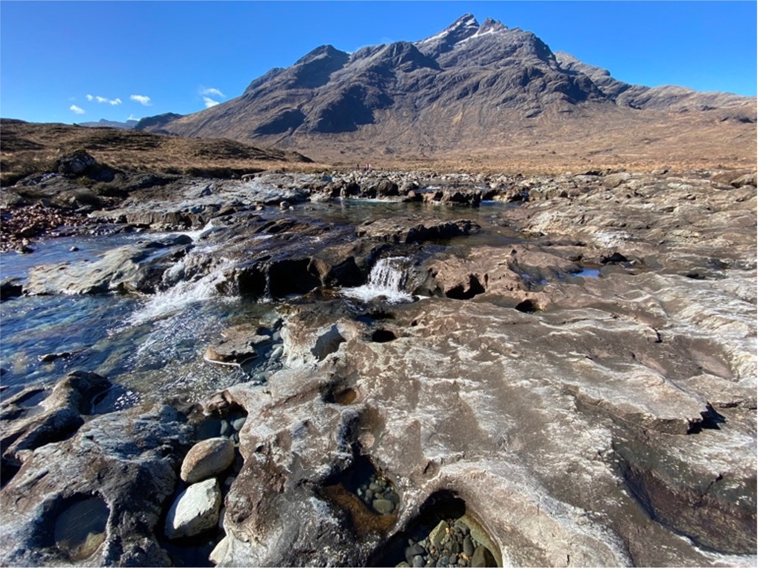 Post-glacial landscape with incising bedrock river in the Scottish Highlands (photo credit: F. Clubb)
/prod01/prodbucket01/media/durham-university/departments-/geography/geographymres/wodroffe_moffa-sanchez1.jpg)
Available Research Projects
See all of the currently available research projects that are recruiting students.
/prod01/prodbucket01/media/durham-university/departments-/geography/76251%5B1%5D.jpg)
Research Masters
Our Research Masters provides an opportunity to develop your research expertise and advanced skills. Pursue your own top or collaborate on a project designed by a supervisor in our world-leading research environment.
Contact Us
Founded in 1928, the Department of Geography at Durham University is one of the leading centres of geographical research and education in the world.
Department of Geography
Postgraduate Study
Durham University
Lower Mountjoy
South Road, Durham
DH1 3LE, UK
Tel: +44 (0)191 33418000
Be social. Be informed. Be a part of Durham Geography.


